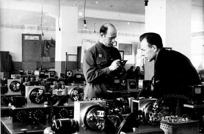
Telegraph Apparatuses Factory
- ID: 497
- Place: Lviv
- Date: 1949

One of the earliest photos of Kyiv depicting the Bessarabska square area in the 1860s. This locality was included in the city limits in the 1840s; at the same time the fountain was constructed (on the left below). The Bessarabska square linked the Pechersk area and the Nova Budova area by Kruhlouniversytetska street. As early as the first part of the nineteenth century peasants started to trade on this square; this commercial activity was intensified after street trade had been transferred here from some other, more “bourgeoised” parts of Khreshchatyk street. Due to the fact that Vasylkivska street, which in its own turn opened way to the south, came out to the square, the latter was given its modern name; the square has continuously been officially named Bessarabska since 1881. It was in this place that the Khreshchatytsky stream fell into the Klov river; a bridge over the water body can be seen in the picture.
The photo depicts also the results of the improvement and beautification of Kyiv in the 1830s when the precipices were filled up, the bridge was built and the fountain was arranged. Judging from the picture, however, the square had no stone sidewalk at that time. In general, here we can see the Bessarabska square as it was before it was turned into one of the main commercial centers of Kyiv of the late nineteenth and early twentieth centuries.
Olga Martyniuk